Subwatershed Studies
Understanding water resources and natural systems is critical to sustainable urban expansion.
We conduct multidisciplinary, big-picture assessments of watershed catchment areas to support infrastructure development, stormwater master plans, secondary plans and other projects. We identify the opportunities and vulnerabilities of natural heritage systems, in order to protect and enhance ecosystems, and assess the potential impact of land use changes over time.

Bringing together multidisciplinary planning and physical science expertise
We collaborate with hydrologists, hydrogeologists, geomorphologists, and ecologists to assess terrestrial, wetland and biological components of a watershed - and how they interact. Our study process includes analysis of vegetation, wildlife and biodiversity, using tools such as:
- Ecological Land Classification
- Floristic Quality analysis
- Significant Wildlife Habitat assessment
- Wetland Evaluations
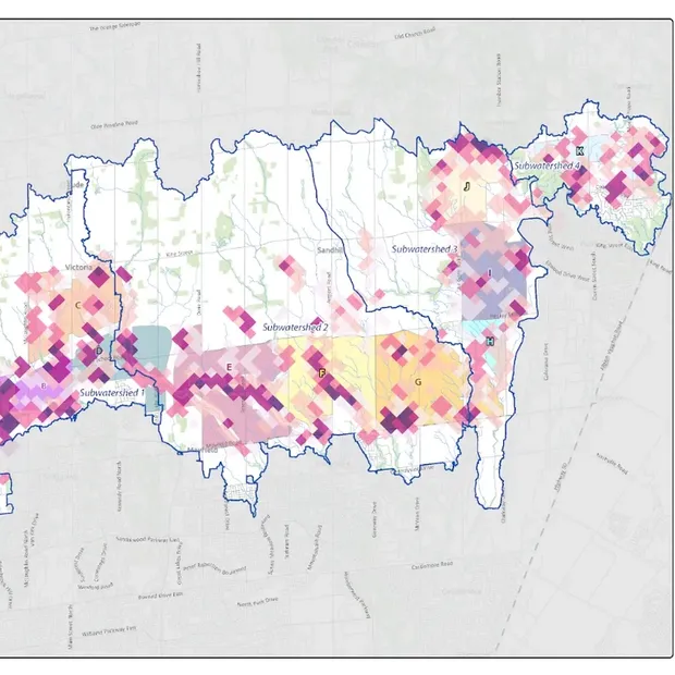
- Geographic Information Systems to document the distribution, quality, dynamics and connectivity of natural habitats in watersheds
Our assessments include an overview of watershed health, significant indicators for longer term monitoring, and recommendations for best practices related to management or restoration of quality ecological systems.

A multi-dimensional approach to understanding the ecology of watersheds
Watersheds are intricately linked to local ecosystems, infrastructure, and agriculture. Our team understands and takes into consideration the multifaceted implications of watershed management solutions.
We employ an integrated approach involving quantitative assessments, as well as consideration of stakeholders including:
- Residents
- Conservationists
- Developers
- Farmers
- Indigenous communities
- Planners
Our satisfied customers include municipalities, conservation authorities, and federal and provincial government agencies.

Comprehensive, ecologically-sound, watershed management plans for complex projects with diverse stakeholders.
At Dougan Ecology it’s our passion to equip clients to realize the ecological potential of every place. Let us help you manage and move complex projects forward with nature-based watershed design that lets nature thrive.

Frequently asked questions about subwatershed studies
A subwatershed study is a comprehensive assessment of a watershed’s natural features, hydrology, and ecology. It aims to understand the impacts of land use changes, including industrial, commercial, mining, and residential development, on water resources and ecosystems, providing a foundation for sustainable development, conservation planning, and environmental decision-making.
Dougan Ecology conducts field surveys and employs quantitative assessments to gauge the ecological health of a watershed. This includes analyzing vegetation, wildlife, hydrological data, soil conditions, and biological indicators. We use mapping, statistical analyses, and ecosystem models to identify long-term monitoring indicators and inform climate adaptation planning.
Wetland evaluations assess the ecological functions and significance of wetland areas within a watershed. Understanding these functions is vital for their role in water filtration, flood attenuation, biodiversity support, and resilience under changing climate conditions.
Ecological Land Classification (ELC) is used to categorize and map the various ecosystems within a watershed. This classification helps in understanding the distribution of natural communities, their ecological functions, and how they contribute to overall watershed health and connectivity.
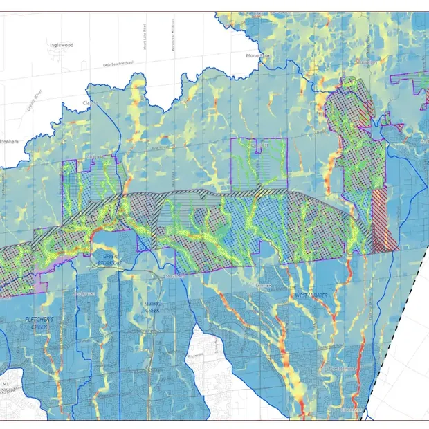
Subwatershed studies provide critical data for designing efficient, adaptive stormwater management systems by identifying areas prone to flooding, erosion, and water quality degradation. This information is vital for aligning infrastructure planning with natural systems and achieving resilient, sustainable solutions.
Ecologists with expertise in landscape-level ecology, such as those at Dougan Ecology, develop a study plan and lead the diverse components of an SWS, based on the goals and objectives of the project. We integrate mapping, hydrologic modelling, ecological assessment, infrastructure interfacing, stakeholder consultation, and EIS support as needed.
